The Tribble Patch, July 29, 2013
(Scroll down for a write-up by Spence as well as a video.)
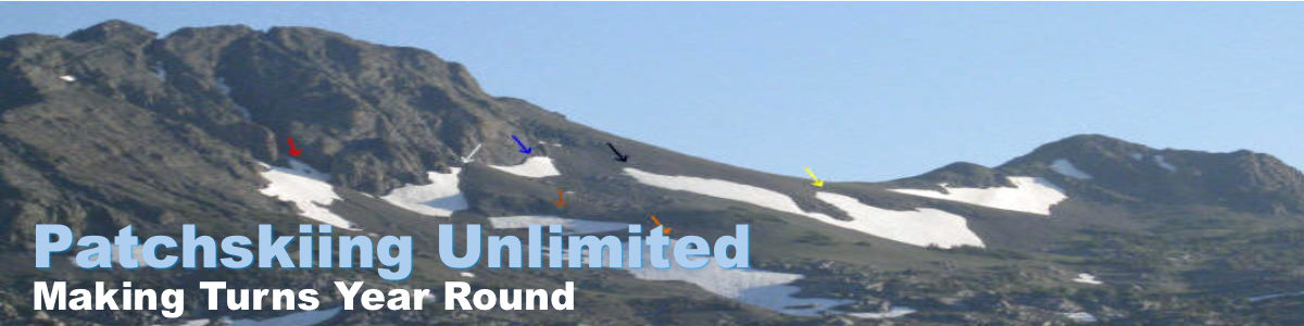
Looking up at the “Bird of Prey” and “Tribble” patches on the drive up:

Portions of “Bird of Prey” can be seen in the center of the photo. The “Tribble” patch can be seen on looker’s right.
Looking across Tamarack Lake, Stev points at the “Tribble Patch”:

Stev rock scrambling above Tamarack Lake on the approach:

A panoramic view from the ridge above the “Tribble” patch:

Spence spraying summer corn snow:

A panoramic view looking down from the top of the “Tribble Patch”:

(L to R: Tamarack Lake, an unnamed lake, Spence bootpacking, Hunewill Lake)
Stev:

Spence is happy with our graffiti:

Spence’s “Tribble” Patch Write-up:
The original (and somewhat ambitious) plan was to tackle the elusive “Bird of Prey” patch located above Tamarack Lake just outside of Bridgeport, CA. My buddy Stev and I have been eying this swatch of snow for a few seasons now and even attempted to ski it as recent as two summers ago, but got skunked after taking a Wages of Fear 4×4 road. As a result, it’s still at the top of the “To Do” list. Having been trumped on skiing the previous week due to lightning storms we decided to score some turns on my days off–Monday and Tuesday. In an attempt to rally hella early, I drove down to Stev’s house from Truckee on Sunday night. Alas, breakfast, discussions about classic movies and random pop culture effluvia turned our proposed early start into more of a late-morning start. We eventually departed Casa de Stev & Michele (his more than gracious wife) around 10 a.m. and were parked at the trailhead and hiking all Gary Cooper stylee (i.e. at High Noon) shortly after.
The hike to Tamarack Lake was without incident, as it’s along a well-marked and well-trodden trail. As we neared Tamarack Lake, Stev and I found ourselves communicating via yells as we had ended up on opposite sides of a large granite deposit. About midway through our shouted conversation we heard what, at first, sounded like kids screaming in rapturous joy. Having seen several piles of horse hooey dotting the trail on the hike up, we presumed that there were equestrian loving revelers bathing in the lake. The elated screams soon multiplied like a large, albeit mutated, chorus of “Row Your Boat” causing us to quickly come to the realization that we had woken up a den of sleeping coyote or wolf cubs. The caterwauling symphony lasted for a few minutes and then went abruptly silent. I attempted to rekindle the sonic chaos with my best American Werewolf in the Easter Sierra howls, but to no avail. Other than the odd squirrel, a few rabbits, a bunch of chukars (these birds be some dumb muthaf@#kars, btw), this was our only encounter with the local fauna.
Once at the lake proper we scoped out our next move and decided to hike around the right side. This consisted of a marked trail, that is until we got to the end of the lake; the hike beyond became interesting, to say the least. The landscape above the lake is strewn with massive fields of boulders, rocks, and stones, intermingled with scree of varying size. The fields of igneous matter are so dense that they permeate the trees, lurk underneath the foliage, and line the sides of the canyons we had to hike through to reach our goal.
After almost 3 hours of bouldering, rock hopping, and scree skipping, not to mention cresting numerous false ridges, we found ourselves face-to-face with a swatch of snow overlooking an unnamed pond between Tamarack Lake and Hunewill Lake, one ridge removed from “Bird of Prey.” Given the time (3 p.m.) and the fact that “BoP” was not only steep (50 degree +), had an abrupt ending with no run-out or easy access, not to mention was easily another hour to 2 hours further on, we scrapped our initial plan (based on time and safety issues) and decided to ski the patch presently in front of us. It was a strange, steep, side hill, but the snow was soft, summer corn with minimal-to-no sun-cups. Having crested the ridge next to the patch (so we could scope out “BoP” for a future trip), we clamored across a side hill of scree, rocks, and semi-loose dirt to enter the snow from the side. As such, we skied the middle section as a warm-up. Then I laid a boot-pack to the top and schussed the skier’s left/looker’s right section. A third boot pack up yielded the final run: top-to-bottom, milking the double fall line.
The hike out saw more trampling over metamorphic masses, the rocks being so prevalent that it prompted me at one point to exclaim “These rocks are like f@#king Tribbles! They just keep multiplying.” This remark, in turn, led to the naming of the patch we’d just skied. As is often the case when naming a patch, the nom de ski tends to randomly generate itself. Having made the Tribble remark I turned back to Stev and asked “Aren’t Klingon warships called “Birds of Prey”?” Stev, being something of a Trekkie, replied, “Yeah they are, why?” To which I responded “Well, I just made a Star Trek reference in regards to these endless protolith protrusions, and we’ve been calling that other patch the “Bird of Prey” (we had named it a few years back as it usually resembles the militaristic bird emblem you seen on many European country flags and family crests), so I think we should just roll with that and call the patch we just skied “The Tribble Patch.” No argument was forth-given by Stev, so “Tribble Patch” it was dubbed.
During the rest of our journey, besides being thwarted by the aforementioned tribbles from the earth’s core, we came across a field of fallen trees (obviously collateral damage from avalanches and slides) that resembled beached giant squids (their roots protruding like a squids head and the branches stretched out in front of them like tentacles). Other’n that, we were back at the Taco Mama by 7, making our truck-to-snow-to-truck time 7 hours (our entire trip, from Stev’s house to trail and back again, was probably 11 hours total).
Video: